


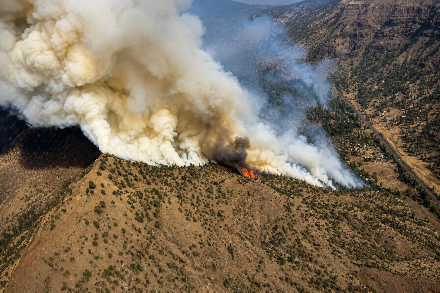
What began as a five-acre lightning fire Thursday evening became a substantially larger emergency before sunrise Friday, spreading across steep Wheeler County terrain, threatening structures and forcing residents near the fire to prepare for the possibility of evacuation.
The Rosenbaum Fire was reported at approximately 7:32 p.m. Thursday, August 13, about four miles north of Service Creek. Firefighters arriving during the initial attack encountered flames moving through grass and timber in vegetation already primed by prolonged summer dryness. Creeping fire and individual torching were observed early, providing an indication that the small ignition had access to enough dry fuel to accelerate quickly.
Within roughly three hours, the estimated footprint had climbed from five acres to approximately 100. More precise mapping Friday morning measured the fire at 232.7 acres, a sharp overnight expansion that transformed the Rosenbaum from a new lightning start into an incident requiring a broader suppression organization.
Fire officials attributed the ignition to thunderstorms that crossed Central Oregon Thursday. Three lightning strikes north of Camel Hump are believed to have started the Rosenbaum Fire, and the terrain soon became part of the challenge confronting crews. As flames worked their way up a steep canyon wall, firefighters reported short-range spotting and increasingly active behavior, allowing burning material to carry fire beyond portions of the main perimeter.
By Friday, the fire was displaying active runs and group torching, a more aggressive pattern in which clusters of trees become involved rather than isolated vegetation burning along the ground. Extremely dry fuels remained a central concern as firefighters attempted to establish control around a fire that had already demonstrated its ability to gain acreage quickly.
The Wheeler County Sheriff’s Office established Level 1 Be Ready and Level 2 Be Set evacuation areas around the incident, including locations near Highway 19 and mileposts 74 and 75. Structures were listed as threatened. No Level 3 Go Now evacuation had been reported in the official incident information available Friday.
For residents within the Level 1 area, the notice means preparations should already be underway in case conditions deteriorate. Level 2 carries greater urgency, advising residents to be prepared to leave with little additional warning. Those designations can change as fire behavior, wind and suppression progress alter conditions along the perimeter.
Highway 19 has become part of the operational landscape as well. Fire traffic, equipment movement and suppression work near the roadway created the possibility of delays and intermittent single-lane closures, placing a major travel corridor directly alongside an active firefighting operation.
The response grew as rapidly as the complexity of the incident. Engines, hand crews and bulldozers were assigned while aviation resources were ordered to reinforce firefighters working from the ground. At 7 a.m. Friday, Oregon Department of Forestry Complex Incident Management Team 3 assumed command, providing the expanded planning, logistics and operational structure needed to manage the developing fire.
The Rosenbaum Fire is burning in a region where firefighting resources have already spent weeks confronting another enormous lightning-caused incident. The Rowe Creek Complex, which began July 15 roughly 10 miles south of Fossil, had reached approximately 373,783 acres by Friday and had nearly 1,500 personnel assigned. Resources working that complex assisted local authorities during the Rosenbaum Fire’s initial response Thursday night.
That overlap illustrates the difficult conditions facing Oregon fire agencies during the middle of August. Crews assigned to long-duration incidents must continue securing established fire lines while remaining prepared for thunderstorms to scatter new ignitions across surrounding forests, grasslands and rangeland. A lightning strike that leaves only a small column of smoke in the evening can become a considerably different operation several hours later when dry vegetation, steep slopes and changing winds align.
The Rosenbaum Fire followed precisely that progression during its first night. It entered Thursday evening as a five-acre fire and reached Friday morning at more than 230 acres, with threatened structures, evacuation preparations, highway concerns and an incident management team taking command.
Firefighters now face the methodical work of limiting further spread while searching for opportunities to strengthen the perimeter across difficult terrain. At the same time, continuing lightning remains a concern because additional strikes can produce new fires that may not immediately reveal themselves.
Residents within the affected Wheeler County evacuation areas should continue following official emergency notifications as suppression operations proceed. Travelers using Highway 19 should also remain prepared for changing traffic conditions while crews, heavy equipment and aircraft continue working the Rosenbaum Fire.