


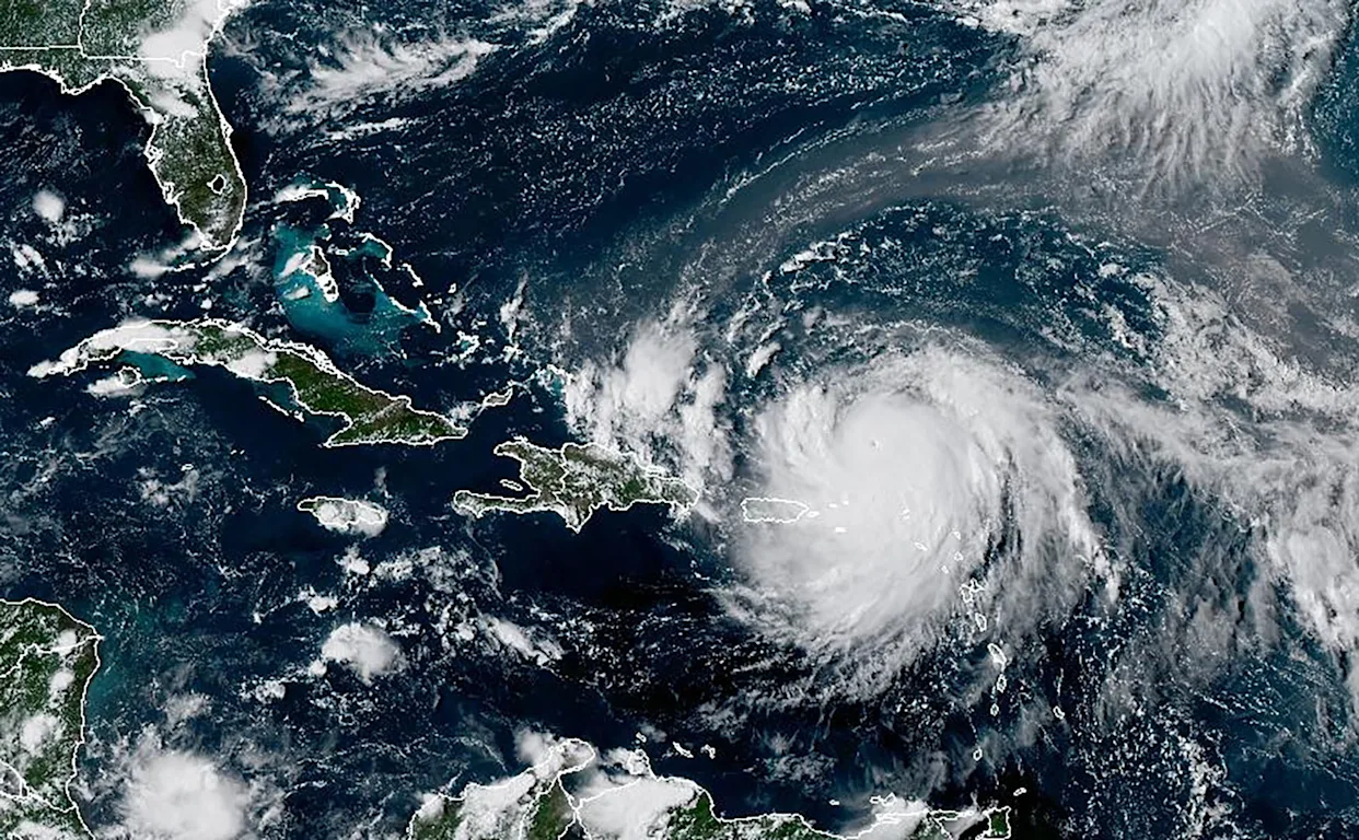
Hurricane Erin, the first major storm of the 2025 Atlantic hurricane season, has exploded into a powerful Category 4 system, sending dangerous swells across the Caribbean and forcing evacuations along portions of the U.S. East Coast. Over the weekend, Erin briefly achieved Category 5 status with peak winds of 160 miles per hour, marking one of the fastest intensifications ever recorded in the Atlantic basin. Within a little more than a day, the storm strengthened from a minimal hurricane to one of the strongest storms on record for this point in the season, underscoring both the volatility and unpredictability of the current hurricane environment.
As of Monday, Erin was tracking north of Hispaniola, carrying sustained winds of about 140 miles per hour. Its wide wind field stretches nearly 230 miles from the eye, pushing rough seas and dangerous surf into surrounding regions. Tropical storm conditions reached into Puerto Rico, the U.S. Virgin Islands, and portions of the Dominican Republic, where heavy rainfall has already triggered flooding and power outages. Some areas have recorded more than ten inches of rain, leaving communities bracing for additional impacts as the storm continues to churn offshore.
The Bahamas and Turks and Caicos remain under tropical storm alerts, with public services suspended in some areas. Authorities have urged residents to remain off the water, and small craft advisories are expected to remain in place through the week. While Erin is not forecast to make a direct landfall in these island nations, the combination of torrential rain, gusty winds, and treacherous seas continues to disrupt daily life.
In the United States, attention has turned to North Carolina’s Outer Banks, where Dare County has declared a state of emergency. Officials have issued mandatory evacuations for Hatteras and Ocracoke Islands amid fears of life-threatening surf and flooding. Forecasts call for waves between 10 and 20 feet along exposed sections of the Outer Banks, with additional high surf advisories posted from Florida through New England. Even areas far removed from Erin’s center are expected to experience elevated tides, dangerous rip currents, and coastal erosion as the storm edges northward.
Forecasters expect Erin to continue on a northerly track through midweek, remaining offshore while curving between Bermuda and the U.S. East Coast. By late week, the storm is projected to swing northeast and head out into the Atlantic, sparing both Bermuda and the mainland United States from a direct strike. Still, the lingering effects of high surf and rough seas are expected to persist for days, particularly along popular beach destinations.
Hurricane Erin has already distinguished itself as an unusual storm. It is only the fifth hurricane in history to achieve Category 5 intensity so early in the season, joining a small group of record-setting storms that intensified at unprecedented speed. Its rapid growth from Category 1 to Category 5 within 24 hours underscores how favorable conditions in the Atlantic—warm sea surface temperatures, low wind shear, and abundant atmospheric moisture—are fueling storms of remarkable strength.
For now, much of the coastline will be spared the direct brunt of its winds, communities from the Caribbean to the Carolinas continue to contend with the dangerous ripple effects of a storm that has already rewritten the seasonal record books.