


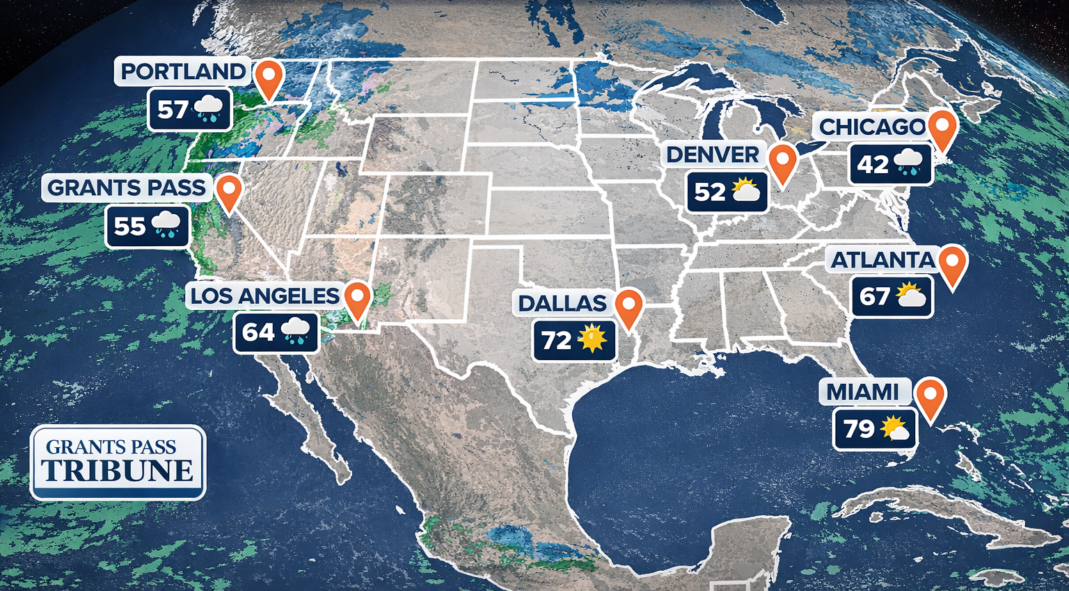
Christmas Day has arrived with a wide range of weather conditions across the United States, offering everything from stormy and wet conditions in parts of the West to unseasonably mild temperatures across much of the South and Central regions. For travelers who have already reached their destinations outside of Oregon, the day’s weather presents a mixed but largely manageable picture depending on location.
Along the West Coast, California is experiencing the most active weather in the country. A strong Pacific storm system continues to push heavy rain into coastal and inland areas, particularly across Northern and Southern California. Widespread rainfall is creating slick road conditions and localized flooding in low lying areas, while higher elevations in the Sierra Nevada are seeing significant snowfall. Mountain communities are dealing with winter conditions that feel more traditional for Christmas, though at the cost of difficult travel through passes and foothill regions. Coastal areas remain cool, damp, and windy throughout the day.
The Pacific Northwest outside of Oregon is seeing calmer but still unsettled conditions. Washington state is experiencing cool temperatures with periods of rain in lower elevations and snow in the Cascades. Fog is lingering in some valleys, keeping visibility low at times. While conditions are not severe, the atmosphere remains firmly wintry with cloud cover dominating the day.
Across the Rockies and Intermountain West, Christmas weather varies by elevation. Higher terrain in Idaho, Montana, Wyoming, Colorado, and Utah is cold with snow cover in place, making for a classic winter holiday feel. Lower elevations are generally dry but chilly, with temperatures hovering below seasonal averages in some areas and closer to normal in others. Sunshine breaks through clouds at times, especially across the interior Southwest.
The Central Plains and Midwest are experiencing relatively calm conditions compared to earlier winter storms this season. Much of the region is dry on Christmas Day, with temperatures running mild for late December. Some areas may see morning fog, particularly near rivers and agricultural regions, but overall the weather remains quiet. Snow cover is limited, leaving many communities with a brown rather than white Christmas.
In the South, Christmas Day feels more like early fall than winter. From Texas through the Gulf Coast and into the Southeast, temperatures are well above average, with some locations approaching record highs for the date. Skies are mostly clear to partly cloudy, and outdoor holiday gatherings are comfortable. Florida is seeing mild and pleasant conditions statewide, making it one of the most favorable regions for outdoor celebrations.
The Northeast and Great Lakes regions are enjoying a relatively calm holiday as well. While colder air remains in place, widespread snowfall is absent on Christmas Day itself. Temperatures are seasonable, skies are mostly cloudy, and conditions remain dry across many urban areas. Winter weather is expected to become more active later in the week, but for Christmas Day the region is experiencing a pause in storm activity.
Overall, Christmas Day weather across the United States reflects a nation divided between winter storms in the West and warmth in the South, with calmer conditions elsewhere. For those already at their holiday destinations, the day offers everything from rain-soaked coastlines to springlike sunshine, underscoring the broad diversity of winter weather across the country.