


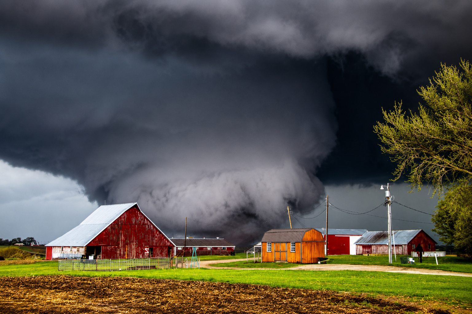
A powerful outbreak of severe weather swept across the nation’s heartland Monday, leaving behind a broad trail of destruction as tornadoes, hurricane-force wind gusts, torrential rain and large hail battered communities from the Upper Midwest into the Great Lakes. Emergency crews spent much of the day responding to damaged neighborhoods, blocked highways, widespread power outages and shattered businesses as meteorologists continued tracking one of the most significant severe weather events of the summer.
The hardest-hit communities were found in northeastern Wisconsin, where a confirmed tornado tore through portions of the Fox Valley, causing extensive destruction in Menasha, Appleton and Fox Crossing. Entire commercial buildings were reduced to piles of debris, roofs were ripped from homes, mature trees snapped at their trunks and vehicles overturned as the tornado carved through residential neighborhoods and business districts.
As daylight returned, first responders moved street by street through damaged areas searching buildings, checking on residents and restoring access for emergency vehicles. Utility crews immediately began the long process of replacing broken power poles, repairing damaged electrical lines and restoring service after tens of thousands of customers lost electricity during the height of the storm.
Authorities reported that entire sections of Menasha were temporarily left without power while emergency shelters opened for residents displaced by damaged homes. Streets that only hours earlier had been lined with businesses and traffic became cluttered with twisted metal, shattered glass, insulation and fallen trees, making travel difficult throughout the affected communities.
Although northeastern Wisconsin experienced the greatest concentration of tornado damage, the same storm system stretched across hundreds of miles and produced dangerous weather in numerous states. Severe thunderstorms developed along a strong frontal boundary fueled by oppressive heat, abundant Gulf moisture and powerful upper-level winds, creating an environment favorable for rotating supercell thunderstorms capable of producing tornadoes alongside destructive straight-line winds.
Throughout the afternoon and evening, tornado warnings were issued across portions of Wisconsin while severe thunderstorm warnings expanded into Illinois, Michigan and surrounding states. Forecasters warned that the storms were capable of producing damaging wind gusts exceeding 75 miles per hour, hail measuring up to two inches in diameter and isolated tornadoes as the system accelerated eastward.
Communities across northern Illinois experienced intense thunderstorms accompanied by torrential rainfall, vivid lightning and damaging wind gusts that created hazardous travel conditions. Portions of the Chicago metropolitan area also experienced heavy rain and localized flooding as the weakening storm complex pushed toward Lake Michigan.
Farther east, portions of Michigan prepared for another round of dangerous weather as the Storm Prediction Center maintained an elevated risk for severe thunderstorms capable of producing widespread wind damage and isolated tornadoes. Emergency management officials urged residents to remain alert as storms continued progressing across the Great Lakes region.
The latest outbreak adds to what has already become an exceptionally active severe weather season across much of the central United States. Repeated episodes of volatile atmospheric conditions during recent months have produced numerous tornado outbreaks stretching from the Southern Plains through the Midwest, leaving many communities recovering from multiple rounds of destructive weather within a single season.
Meteorologists explained that Monday’s storms formed as extremely warm, humid air collided with a strong advancing cold front while powerful winds several thousand feet above the surface created favorable conditions for rapidly rotating thunderstorms. Once individual storms began organizing, several intensified into supercells capable of producing tornadoes before eventually merging into a larger line of severe thunderstorms that continued moving east.
In addition to tornadoes, straight-line winds became a major hazard across a wide portion of the Midwest. These powerful winds can often rival weaker tornadoes in strength, producing widespread tree damage, downed power lines, structural failures and extended electrical outages even in locations where tornadoes never develop.
As emergency response efforts continued Monday evening, damage assessment teams from the National Weather Service began preparing detailed ground surveys to determine the exact number of tornadoes that occurred, their paths, estimated wind speeds and ratings on the Enhanced Fujita Scale. Those surveys are expected to continue over the coming days as officials examine structural damage, tree fall patterns and radar data.
Despite the widespread destruction, emergency officials credited advanced weather forecasting, timely warnings and public preparedness for helping many residents seek shelter before the strongest storms arrived. Search-and-rescue operations continued well into the evening as crews carefully inspected damaged homes, businesses and public buildings while utility workers worked to restore essential services.
The severe weather threat diminished as the storm system moved farther east Monday night, but forecasters cautioned that additional rounds of summer thunderstorms remain possible in coming days as warm, moisture-rich air continues flowing across much of the central and eastern United States. For many communities across the Midwest, however, the immediate focus has shifted from watching the skies to clearing debris, restoring power and beginning the long process of rebuilding after another destructive chapter in an already active severe weather season.