


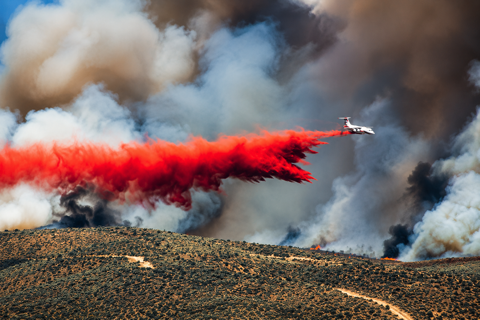
Oregon has entered territory no previous wildfire season in the state has reached. More than 2.3 million acres have burned across Oregon in 2026, pushing the state beyond the all-time acreage record established just two years ago. The new record arrived not at the end of fire season, but by August 10, while major fires remain active from Southern Oregon to the Idaho border and thousands of firefighters continue working across the Northwest.
Approximately 2.336 million acres have burned statewide this year. That is roughly 436,000 acres beyond the previous record of approximately 1.9 million acres set during the destructive 2024 season, an increase of about 23 percent. Measured another way, Oregon has lost roughly 3,650 square miles to wildfire this year. The acreage is more than three and a half times the 10-year seasonal average of approximately 640,000 acres cited by state officials following the 2024 season.
Behind those numbers is a fire map stretching across much of Oregon. Eastern Oregon has carried some of the largest acreage, led by the Big Grass Fire near the Oregon-Idaho border in Malheur County. The fire has grown beyond 500,000 acres, making it one of the defining incidents of the 2026 season. The massive rangeland fire has required an extended suppression operation while evacuation orders and warnings have affected rural communities and properties throughout the region.
Across Central Oregon, the Rowe Creek Complex has burned through portions of Crook, Jefferson, Wasco and Wheeler counties. Firefighters have made substantial gains in containment, but the complex has required extensive ground and aerial resources and generated evacuation notices as changing conditions threatened communities across its path.
The Grasshopper Fire has added another major incident to the state’s fire load in the Mount Hood region, where firefighters have worked through difficult terrain while evacuation notices have affected surrounding areas. Other fires have complicated operations around the Mount Hood National Forest, with the Austin, Mitchell and Narrows fires among incidents reported over the weekend. Those new starts added additional demands while crews and equipment were already committed to larger fires elsewhere in Oregon and across the Northwest.
In Wheeler County, the lightning-caused Shingle Fire has burned tens of thousands of acres since beginning July 23 southeast of Mitchell. Hundreds of firefighters and support personnel have been involved in the response, backed by engines, hand crews and aviation resources. The Bench and Round Butte fires have added tens of thousands of additional acres to the statewide total, although containment has increased considerably on those incidents.
Across the open country of eastern and southeastern Oregon, fires including the Flat Fire have moved through grasslands and rangelands where dry vegetation, wind and low humidity can allow relatively small starts to expand rapidly. The sheer size of several eastern Oregon fires has helped drive the statewide acreage total beyond the record established in 2024.
Southern Oregon has not escaped the increasingly crowded fire map. In Klamath County, the Wrights Spring Fire has grown to approximately 46,769 acres and remained at zero percent containment Monday as crews concentrated on stopping movement along portions of the perimeter. Evacuation levels have shifted around the Sprague River area and neighboring communities as fire behavior and suppression conditions have changed.
The Wrights Spring Fire has also brought one of the season’s most serious losses. A 47-year-old Klamath Falls man working with firefighting operations was killed while operating a bulldozer in the Yahwee Plateau area. The fatality occurred as firefighters and heavy-equipment operators continued working across a large and difficult fire perimeter.
West of Klamath County, firefighters have continued securing the Woodrat Mountain Fire in Jackson County. The fire was mapped at approximately 282 acres, with hose line established around the perimeter as crews moved deeper into mop-up operations. The comparatively smaller acreage illustrates the range of incidents confronting Oregon firefighters this season, from fires measured in hundreds of acres to enormous rangeland fires measured in hundreds of thousands.
Josephine County also recorded another fire Sunday when flames broke out along Redwood Highway near Cave Junction. What began as a grass and brush fire drew ground crews, air attack and a Type 2 helicopter as wind pushed the flames. Helicopter bucket drops supported firefighters on the ground while authorities asked motorists and residents to stay clear of the firefighting operation.
Those incidents are unfolding within a national wildfire system operating at its highest readiness level. The United States remained at National Preparedness Level 5 Monday, meaning firefighting resources were heavily committed nationwide. Nearly 30,000 personnel were assigned to wildfire operations across the country, with more than 6 million acres burned nationally during 2026. Oregon alone accounts for a substantial portion of that nationwide acreage, adding pressure to a resource-sharing system simultaneously responding to major fires elsewhere in the West.
Federal assistance has already followed the expanding Oregon fire season. FEMA authorized firefighting assistance for the Rowe Creek Complex West Zone earlier this month, representing the fifth Fire Management Assistance Grant declaration involving Oregon wildfires in 2026 at that point in the season. Such declarations allow eligible firefighting expenses to receive federal assistance when a fire threatens enough destruction to constitute a potential major disaster.
The record also carries a financial history Oregon knows from its previous severe fire season. The 2024 wildfire season, previously the largest by acreage, generated more than $350 million in gross wildfire costs. The financial burden eventually resulted in a special legislative session as Oregon worked to cover firefighting obligations while awaiting federal reimbursements.
Fire suppression is only one portion of the aftermath. Large burns can alter watersheds, increase erosion, damage wildlife habitat, affect stream temperatures and water quality, and leave state, federal, tribal and private landowners facing restoration work long after active firefighting operations have ended. Oregon experienced those consequences following the 2024 season, when approximately 1.9 million acres burned across 21 counties.
Evacuation notices remain especially important as fires continue moving across Oregon. Level 1 means residents should be ready, Level 2 means they should be set to leave and Level 3 means leave immediately. Because evacuation boundaries can change quickly with wind, weather and fire behavior, residents near active incidents are being directed to follow county sheriff and emergency-management notifications for the latest information affecting their communities.
Oregon’s previous benchmark stood at approximately 1.9 million acres after the extraordinary 2024 season, but by August 10, 2026 had moved approximately 436,000 acres beyond that record. With approximately 2.336 million acres already burned, active fires continuing across multiple regions and weeks of the traditional wildfire season still ahead, the final dimensions of Oregon’s 2026 wildfire season have yet to be determined. The 2.3-million-acre mark is no longer a measure of what the season could become; it is the measure of what has already burned.