


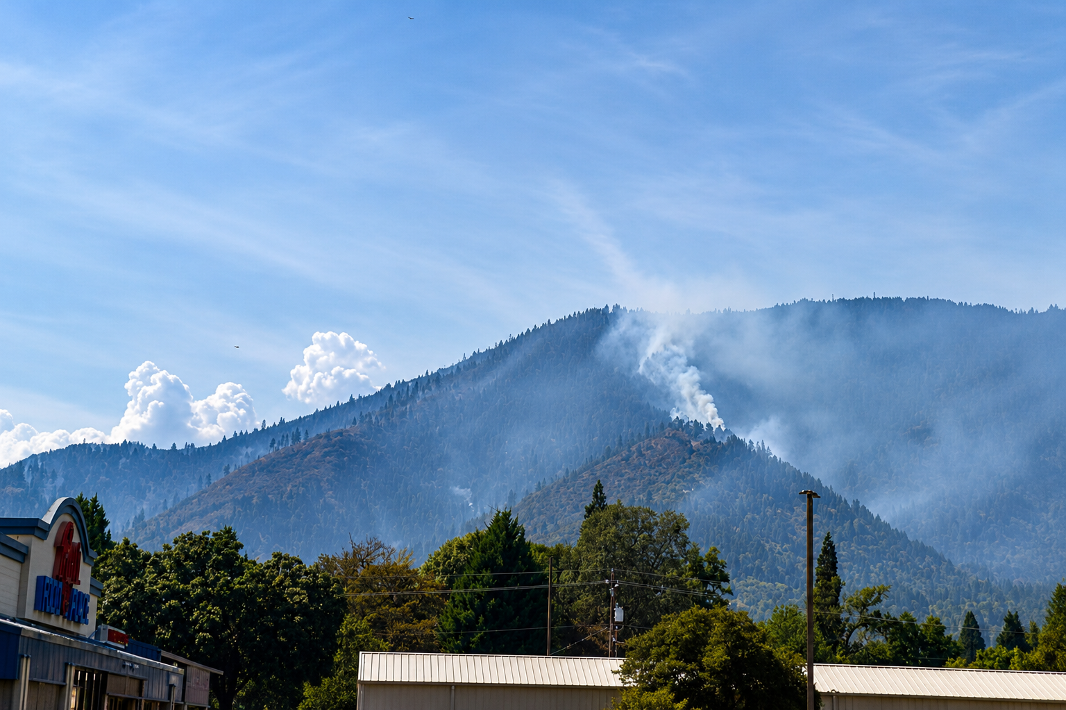
Saturday morning brought a noticeably different picture from the hills above Rogue River, where firefighters have now wrapped control line around roughly three-quarters of the Fielder Mountain Fire after two days of difficult work on steep, dry ground. The wildfire remains estimated at approximately 550 acres and 7 percent contained, leaving evacuation orders in place while crews concentrate on closing the remaining perimeter and securing miles of line already constructed.
The absence of another major increase in acreage is among the most important developments in the latest reporting period. Fielder Mountain raced to approximately 550 acres during its initial run Thursday and into Friday, propelled through dry grass, brush and timber as firefighters contended with wind, rugged slopes and limited access. The latest available figures continue to hold the fire near that acreage rather than showing another substantial expansion.
Firefighters have simultaneously pushed control line around approximately 75 percent of the perimeter, giving crews a more defined boundary from which to work. That figure is considerably higher than the official containment percentage because constructing a line around a wildfire and declaring that line secure are two separate stages of suppression.
Containment remains at 7 percent while crews reinforce those barriers, extinguish heat along the edges and evaluate whether individual sections can withstand changing winds, burning trees, rolling debris and airborne embers. Only after a section is considered sufficiently secure does it become part of the official containment calculation.
The difference is particularly important on Fielder Mountain, where terrain has dictated much of the firefighting strategy. Bulldozers can operate on some portions of the incident, but other sections require firefighters to advance on foot, constructing hand line and pulling hose uphill through country that provides few easy approaches.
Aircraft have worked above those ground crews, delivering water and retardant where direct access is difficult and helping slow fire activity while firefighters establish line below. Spot fires have added another complication, requiring crews to address flames outside portions of the primary burned area rather than concentrating exclusively on the main perimeter.
Oregon Department of Forestry Complex Incident Management Team 1 has assumed command of the fire, adding management capacity to an incident that quickly grew beyond its initial roadside response. Bringing in the specialized team also helps preserve firefighters and equipment elsewhere in the Southwest Oregon District, where extremely dry vegetation continues to leave Jackson and Josephine counties susceptible to additional fires.
The greatest immediate consequence remains the evacuation of neighborhoods around Rogue River. Approximately 1,000 people were reported under Level 3 GO NOW orders Friday, primarily within Rogue River and areas west of the city, while roughly 2,000 additional residents across Jackson and Josephine counties were under Level 1 or Level 2 evacuation notices.
Those figures illustrate how quickly a wildfire of several hundred acres can disrupt a much larger area than the ground it has actually burned. Evacuation boundaries account not only for the existing perimeter but also potential fire movement, road access, terrain and the time residents may require to safely leave.
Residents within evacuation areas should continue following current information from Jackson and Josephine county emergency officials rather than relying on maps or notices issued earlier in the incident. Level 1 calls for residents to remain aware and prepare for possible evacuation. Level 2 means residents should be ready to leave immediately, particularly anyone who requires additional time to move family members, animals or essential belongings. Level 3 means leave immediately.
North Middle School in Grants Pass has been designated to receive evacuated residents and pets. The Jackson County Expo in Central Point has been available for livestock, an important consideration in the rural areas surrounding Rogue River where evacuation can involve horses and other large animals that cannot be moved quickly.
Interstate 5 is open after fire activity disrupted travel Thursday near Milepost 51 north of Rogue River. The freeway’s reopening restores the primary north-south transportation route through the area, although motorists should remain prepared for smoke, emergency vehicles, firefighting equipment and changing traffic conditions near the incident.
The fire’s rapid development also prompted Oregon to request federal assistance. A Fire Management Assistance Grant was authorized, making federal reimbursement available for up to 75 percent of eligible firefighting expenses associated with the incident. The program assists with qualifying suppression costs rather than providing individual disaster payments to residents.
At the time federal assistance was requested, authorities reported that the fire threatened homes around Rogue River as well as electrical transmission and distribution infrastructure, businesses, a school, campgrounds and a hotel.
Investigators have not issued a final determination on how the Fielder Mountain Fire started. Preliminary information indicated tires on a semi-truck were burning before flames entered roadside vegetation near Interstate 5, but the official cause remains under investigation. Until that process is completed, the preliminary circumstances should not be treated as a confirmed cause.
Attention on Saturday turns increasingly toward the unfinished sections of perimeter and the ability of crews to convert constructed line into secure containment. Firefighters must search for lingering heat, remove or address hazardous burning vegetation near the edge and prevent embers or rolling material from carrying fire back into unburned country.
That work is less visible than the towering smoke and aircraft activity that accompanied the fire’s initial expansion, but it determines whether the perimeter ultimately holds. On steep terrain, even a relatively small pocket of heat can create problems if winds increase or burning material crosses a line into receptive vegetation.
For Rogue River, the latest numbers offer a clearer measure of progress without removing the need for caution. The fire has remained near 550 acres in the latest available reporting, crews have established line around approximately 75 percent of its perimeter and a larger incident-management organization is now directing suppression efforts. At the same time, official containment remains at 7 percent and evacuation notices continue across portions of two counties.
The next operational report should provide the first fuller assessment of Saturday conditions, including whether overnight work produced additional containment, whether the acreage estimate has changed and whether evacuation boundaries can be adjusted.
Until those figures are released, Southern Oregon residents should regard the Fielder Mountain Fire as an active incident with improving control lines but unfinished work ahead. Rogue River remains at the center of the response, firefighters remain on the mountain, and evacuation alerts remain essential information for the communities surrounding the fire.