


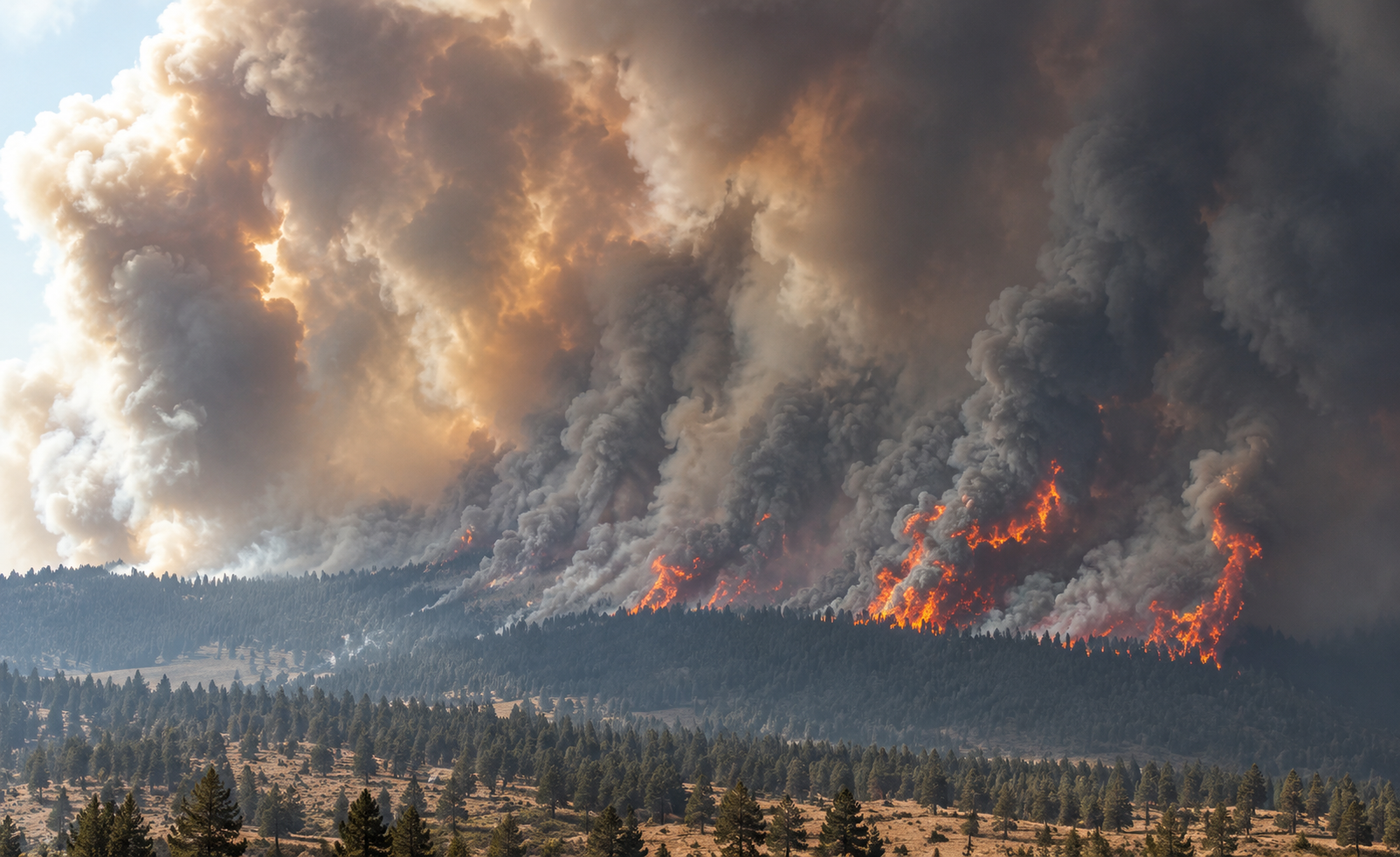
The Austin Fire has grown to approximately 4,800 acres in the Mount Hood National Forest, where firefighters are working through steep, heavily timbered terrain while evacuation notices and federal forest closures remain in effect. The fire, burning about 25 miles southeast of Estacada in Clackamas County, remained at zero percent containment Sunday, August 23, after expanding substantially during its first two weeks.
The fire began August 9 within the Clackamas River Ranger District and was initially estimated at only a few dozen acres. Its footprint increased to approximately 1,800 acres by August 14 and reached roughly 3,000 acres several days later before climbing to about 4,800 acres by Sunday. The continued growth has kept crews working across a difficult section of the national forest where steep slopes, dense timber and limited access have complicated efforts to secure the perimeter.
Firefighters have also been dealing with the Austin Fire after it crossed the Clackamas River, extending burning activity into additional terrain within the drainage. Rivers and other geographic features can provide useful control points during wildfire suppression, but they do not guarantee that a fire will remain on one side. Crews have continued evaluating areas where control lines can be constructed and defended while maintaining safe access for personnel and equipment.
The reported zero percent containment reflects the amount of perimeter that fire managers can officially classify as secured. It does not indicate an absence of firefighting activity. Before sections of a wildfire can be counted as contained, crews must establish control lines or use existing barriers that managers determine are sufficiently secure to prevent additional spread from that portion of the perimeter. Work can include preparing roads, clearing vegetation, constructing fireline and identifying locations where firefighters can operate safely in changing conditions.
Clackamas County has maintained evacuation notices associated with the Austin Fire, including a Level 3 evacuation designation affecting the immediate fire area. Level 3 is Oregon’s highest evacuation level and directs people within the designated zone to leave immediately. Evacuation boundaries can be expanded, reduced or otherwise adjusted as emergency officials receive new information about fire movement, weather conditions and suppression progress.
The wildfire has also restricted access to a substantial portion of the Clackamas River Ranger District. The U.S. Forest Service has established closures associated with the Austin and nearby Mitchell fires, affecting National Forest System roads, forest areas and recreational routes, including Burnt Granite Trail No. 595. The restrictions are intended to keep the public away from active fire operations and maintain access for firefighters, engines and other emergency resources working within the area.
Those closures affect an area of the Mount Hood National Forest regularly used for camping, hiking, fishing, hunting and other outdoor recreation. Travelers planning to enter the Clackamas River Ranger District should verify current Forest Service closures and county evacuation information before departing, particularly because access can change as fire operations move into different portions of the forest.
The Austin Fire is developing alongside a very different situation on the much larger Grasshopper Fire. Grasshopper has burned more than 90,000 acres in the Mount Hood region but has reached substantial containment after weeks of suppression work. The Oregon State Fire Marshal has begun releasing some structural firefighting resources from that incident as crews secure more of its perimeter and conditions allow personnel and equipment to be reassigned.
Although Austin is considerably smaller than Grasshopper, its zero percent containment places the two fires at different stages of suppression. Acreage measures how much land is within a mapped fire perimeter, while containment measures how much of that perimeter has been secured against further spread. A large wildfire can therefore have substantial containment while a smaller incident remains entirely uncontained because of terrain, access, fire behavior or the amount of completed control line.
The Austin Fire is primarily a federal incident because it is burning within the Mount Hood National Forest. The U.S. Forest Service is responsible for much of the incident-specific suppression and closure information, while the Oregon Department of Forestry, Oregon State Fire Marshal, county emergency officials and local agencies remain part of the larger system coordinating wildfire resources and public safety throughout Oregon.
No verified information from the Oregon Department of Fish and Wildlife currently documents significant wildlife losses specifically attributed to the Austin Fire. Wildfires can temporarily displace wildlife and alter habitat, but acreage alone does not establish the extent of ecological damage. Effects can vary considerably depending on fire intensity, vegetation, habitat conditions and burn severity across different portions of the perimeter.
For communities elsewhere in Oregon, including Southern Oregon, the Austin Fire does not currently present a direct evacuation threat. Its continued growth adds another active incident to an already demanding statewide wildfire season, requiring personnel, equipment and logistical support while Oregon fire agencies remain prepared for additional starts during the remaining weeks of summer.
The Austin Fire has changed considerably since its first few dozen acres were reported August 9. By Sunday, approximately 4,800 acres were within the fire perimeter, containment remained at zero percent, evacuation notices continued around the incident and federal closures remained in place across portions of the Clackamas River Ranger District. Firefighters will continue working through the Mount Hood terrain to establish and secure control lines as conditions permit, with acreage, containment, evacuations and public-land closures subject to revision as new mapping and operational information becomes available.