


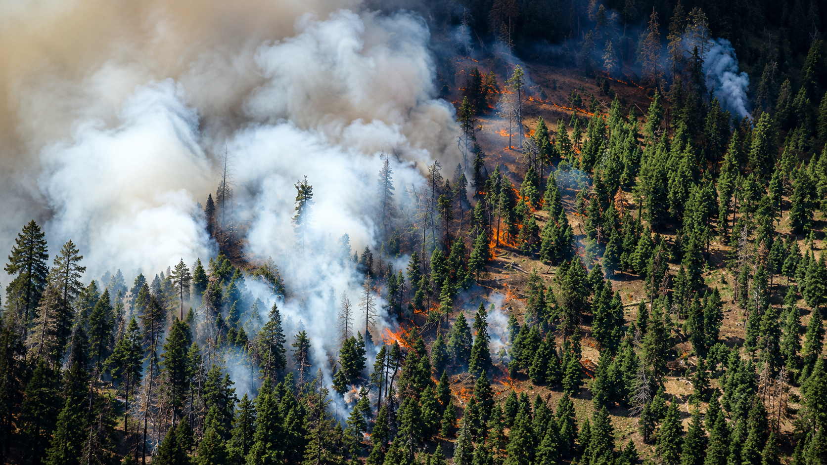
Oregon’s wildfire emergency intensified dramatically this weekend after an extraordinary wave of lightning ignited dozens of fires across the state, rapidly transforming isolated starts into major wildfire complexes that are now burning across hundreds of thousands of acres, forcing evacuations in multiple counties, destroying homes, blanketing much of the Pacific Northwest in smoke, and triggering one of the largest coordinated firefighting operations Oregon has undertaken this year.
The scope of the emergency extends far beyond any single fire. From the wheat fields of northeastern Oregon to the forests and canyon country of central and north central Oregon, firefighters are confronting an expanding network of lightning-caused wildfires that continue testing emergency resources as new ignitions emerge almost as quickly as crews gain ground on existing incidents. With firefighting assets committed across multiple regions simultaneously, Oregon has entered the highest level of national wildfire preparedness, a designation reserved for periods when demand for firefighters, aircraft, heavy equipment, and incident management teams reaches its most critical point.
The rapid escalation began after powerful thunderstorms crossed much of Oregon, producing thousands of lightning strikes but little meaningful rainfall. Instead of extinguishing potential ignitions, the storms scattered fire across landscapes already primed for combustion after months of drying vegetation, prolonged heat, critically low humidity, and persistent wind. Many of the initial strikes smoldered unnoticed beneath grasslands, brush, and timber before emerging days later as weather conditions deteriorated. Others spread almost immediately, racing through fine fuels before climbing into heavier vegetation where suppression efforts became increasingly difficult.
Within only a matter of days, what initially appeared to be numerous independent fires evolved into one of the busiest wildfire periods Oregon has experienced in recent years. Fire managers found themselves balancing aggressive initial attacks on newly discovered fires while simultaneously shifting resources toward rapidly expanding incidents that demanded hundreds of firefighters, specialized equipment, aircraft, and logistical support.
The Hay Creek Complex has become the clearest illustration of how quickly this wildfire outbreak has evolved. Now exceeding 92,000 acres, the complex has grown into Oregon’s largest active wildfire after numerous lightning-caused fires merged under extreme burning conditions. Fire behavior has remained unpredictable as wind, steep terrain, heavy grass, brush, and timber repeatedly combined to produce long runs across the landscape. Large smoke columns rising above the fire have become visible for miles, while crews continue constructing containment lines, protecting threatened homes and infrastructure, and positioning resources ahead of advancing fire activity whenever weather conditions permit.
Farther south, the Rowe Creek Complex has followed a remarkably similar pattern. What began as several separate lightning ignitions eventually combined into another major incident now exceeding 36,000 acres. The expanding fire forced emergency officials to issue evacuation notices across portions of Wheeler County while Oregon activated additional structural firefighting resources to strengthen protection around homes, ranches, agricultural operations, and rural communities lying in the path of potential fire growth.
For many residents living within evacuation zones, the emergency has unfolded in stages measured not by acreage totals but by increasingly urgent notifications. Vehicles have been packed, livestock relocated, important documents gathered, and families forced to make difficult decisions about what possessions can realistically accompany them should evacuation orders become immediate. Throughout rural Oregon, those preparations have become an unfortunate but familiar reality as wildfire seasons continue growing longer and more complex.
The human cost of the current outbreak is perhaps most visible in Umatilla County, where the Lower Dry Creek Fire swept through rural properties near Athena, destroying at least six homes while also consuming dozens of barns, shops, storage buildings, and agricultural structures. Although firefighters have succeeded in increasing containment and reducing evacuation levels in some locations, portions of the fire area remain under mandatory evacuation while crews continue extinguishing hotspots, strengthening containment lines, and reducing the possibility of additional flare-ups during periods of hotter weather.
Elsewhere, residents near Antelope remain under Level Three evacuation orders as firefighters work to prevent advancing fire from reaching additional homes and ranches. Emergency managers continue emphasizing that wildfire behavior can change with little warning under current weather conditions, particularly during afternoon periods when rising temperatures, decreasing humidity, and stronger winds often combine to produce the most aggressive fire activity of the day.
The challenge confronting firefighters extends beyond the largest incidents making statewide headlines. Across Central Oregon, agencies continue responding to numerous lightning-caused fires scattered across public and private lands. Some are entirely new ignitions discovered after the initial storms, while others are holdover fires that remained concealed beneath forest litter and heavy fuels before reappearing as conditions became increasingly favorable for fire growth. Every new report requires personnel, equipment, aircraft, and command resources that are already stretched across multiple large incidents.
That constant emergence of additional fires has transformed wildfire suppression into a statewide balancing act. Incident commanders must decide where aircraft can provide the greatest benefit, where additional engines should be assigned, and which newly reported fires require immediate aggressive attack before they develop into the next large complex. Those decisions occur continuously throughout the day as weather changes, fire behavior evolves, and reports of new ignitions arrive from across Oregon.
The wildfire emergency is also being measured far beyond active fire lines. Smoke generated by the state’s largest fires has spread across much of Oregon and into neighboring states, creating persistent air quality concerns for communities located far from the flames themselves. Residents throughout Central Oregon, Eastern Oregon, the Columbia Gorge, the Willamette Valley, and Southern Oregon have experienced varying degrees of smoke as shifting winds transport fine particles across hundreds of miles. In many locations, mountain ranges that typically define Oregon’s landscape have disappeared behind dense layers of haze, while outdoor activities have become increasingly dependent upon daily air quality conditions.
The regional nature of the emergency has also strengthened cooperation throughout the Pacific Northwest. Firefighters, engines, aircraft, heavy equipment operators, and incident management teams continue moving across state lines as agencies coordinate one of the region’s largest emergency responses of the summer. Resources from neighboring states are working alongside Oregon crews while local departments maintain readiness for whatever new incidents may develop during the coming days.
Despite the enormous commitment of personnel and equipment already deployed, fire officials acknowledge that weather remains the single greatest factor influencing the weeks ahead. Forecasts continue calling for hot temperatures, exceptionally dry vegetation, critically low humidity, and periods of gusty afternoon winds capable of accelerating fire spread. Equally concerning is the continued possibility of additional thunderstorms capable of producing widespread lightning without delivering sufficient rainfall to reduce fire danger. Under those conditions, every storm has the potential to repeat the cycle that created the current emergency.
For communities across Oregon, wildfire season has become far more than a seasonal inconvenience. It now influences public health, transportation, agriculture, recreation, tourism, emergency management, and the daily decisions made by families living in both urban and rural communities. Residents monitor evacuation maps as routinely as weather forecasts. Smoke forecasts have become as important as temperature predictions. Fire restrictions shape work schedules, outdoor activities, and travel plans across much of the state.
While firefighters continue making progress on individual incidents, the broader emergency remains fluid. Large fires continue burning across multiple regions, evacuation notices remain in effect for threatened communities, new lightning-caused ignitions are still being discovered, and weather conditions continue favor rapid fire growth. Until widespread rainfall, cooler temperatures, and higher humidity return to the Pacific Northwest, Oregon’s firefighting effort will remain focused on containing an evolving statewide emergency that has already reshaped the summer across one of America’s most fire-prone landscapes.