


A powerful and rapidly advancing complex of severe thunderstorms tore across the Midwest on Tuesday, August 11, leaving more than one million electricity customers without power as destructive winds swept through Illinois, Indiana and Ohio before spreading into Kentucky and other portions of the Ohio Valley. The sprawling weather system brought torrential rain, intense lightning and winds capable of reaching approximately 80 mph, while severe thunderstorm and tornado warnings followed the storms across state lines. By Tuesday afternoon, widespread electrical failures had become one of the clearest indications of the enormous geographical reach of the outbreak.
The scale of the disruption grew dramatically as the storms advanced eastward. An earlier national count showed more than 880,000 electricity customers without service, but that figure continued climbing and eventually surpassed one million as additional communities lost power. Indiana emerged as one of the hardest-hit states, with roughly 360,000 customers without electricity at one point, while Ohio recorded approximately 290,000 outages and Illinois approximately 230,000. Kentucky added more than 100,000 outages as severe thunderstorms pushed farther into the Ohio Valley, even as utility crews were already attempting to restore service in areas struck earlier in the day.
Because outage statistics count electrical customers rather than individual residents, the number of people directly affected was substantially greater than the customer totals alone suggest. A single residential account can represent an entire household, while commercial accounts can represent businesses employing dozens or hundreds of people. Across the storm corridor, electrical failures affected homes, businesses and public infrastructure while creating the potential for darkened traffic signals, interrupted communications, closed businesses and other complications that accompany widespread power loss.
Northern Illinois and the greater Chicago region were among the first major population centers in the path of Tuesday’s storms. Forecasters had warned that the strongest thunderstorms could generate wind gusts approaching or exceeding 80 mph, velocities capable of snapping large tree limbs, uprooting mature trees, damaging roofs and bringing utility poles and electrical lines to the ground. The storms moved quickly through the region, producing widespread disruptions before continuing toward the Illinois-Indiana state line.
The severity of Tuesday’s outbreak was not dependent upon tornadoes. Although tornado warnings were issued and rotating thunderstorms remained part of the threat, powerful straight-line winds represented a major danger across a much broader area. A tornado typically damages a relatively concentrated corridor, while an organized line or complex of thunderstorms can drive destructive winds across numerous counties and metropolitan areas. When those winds encounter heavily wooded neighborhoods and extensive above-ground electrical networks, outages can multiply rapidly across large sections of a utility system.
As the storms crossed into Indiana, another major wave of electrical failures developed. Northwestern Indiana was particularly hard hit, including Lake County near the Illinois state line, where extensive outages were reported. Severe thunderstorms continued racing across the state with the potential for winds between 60 and 80 mph, accompanied by torrential rainfall, frequent lightning, localized flooding, hail and the possibility of brief tornado development. The combination of powerful winds and fast storm movement meant conditions could deteriorate within minutes as thunderstorms approached individual communities.
The speed of the system also complicated the public-safety challenge. Thunderstorms moving at speeds comparable to highway traffic can cover considerable distances between the issuance of a warning and their arrival in another community. Residents who had experienced relatively calm conditions could quickly encounter rapidly increasing winds, blinding rainfall and dangerous lightning as the leading edge of the storms arrived, making timely weather warnings especially important throughout the affected region.
By Tuesday afternoon, the severe-weather corridor had pushed into Ohio, extending the destructive path farther across the Midwest and into the Ohio Valley. Severe thunderstorm and tornado warnings were issued in portions of the state, including areas around the Cincinnati metropolitan region, as forecasters continued tracking storms capable of producing damaging winds. Kentucky also experienced substantial electrical outages as the same broader weather pattern expanded south and east.
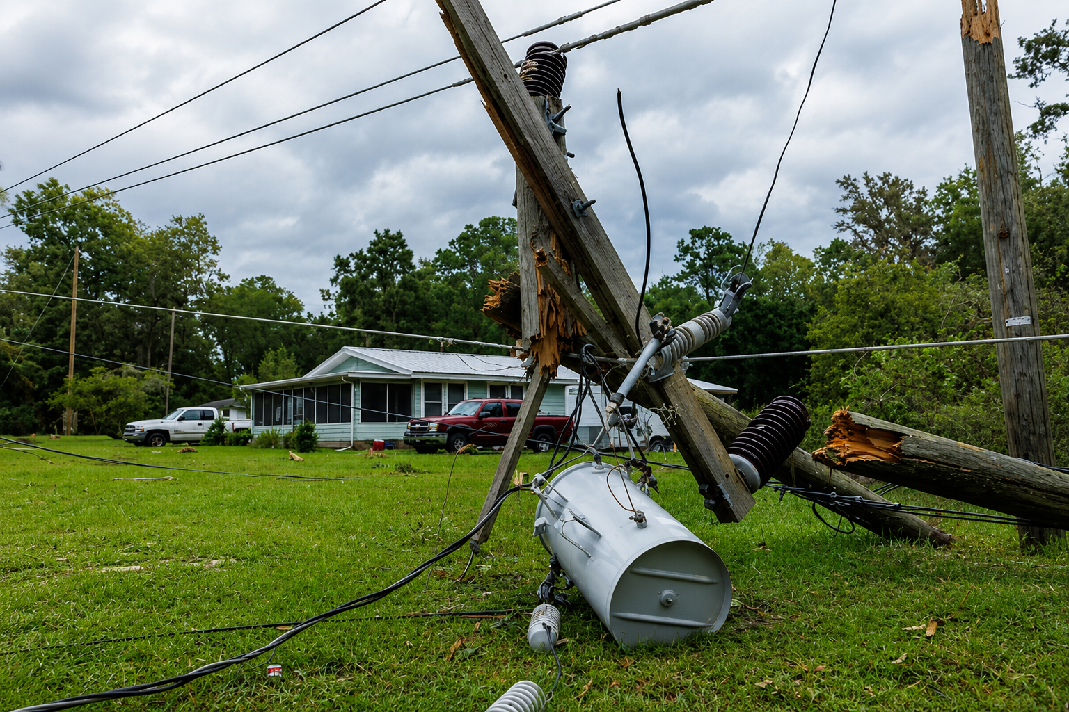
For electric utilities, the departure of the storms marked the beginning of an enormous and complicated restoration effort rather than the end of the emergency. Widespread wind damage can produce thousands of separate failures across an electrical network, forcing crews to inspect transmission equipment, substations, distribution circuits, transformers, poles and individual service connections. Trees and large branches tangled in power lines can further delay repairs because vegetation must often be safely removed before electrical crews can reach damaged equipment.
Restoration work generally begins with infrastructure capable of returning electricity to the greatest number of customers. Major transmission facilities, substations and primary distribution circuits receive priority before crews move deeper into neighborhoods and individual service areas. That process means two homes only a few miles apart can experience dramatically different restoration times depending upon the type and location of the damage affecting their electrical service. Where poles have snapped or transformers have been destroyed, crews may have to rebuild portions of the system rather than simply restore an interrupted circuit.
The widespread outages also created hazards that could remain after skies cleared. Downed electrical lines can remain energized even when surrounding buildings have lost power, and fallen trees can conceal dangerous wires beneath branches and debris. Flooded streets can create additional hazards for motorists and emergency crews, particularly when water obscures damaged pavement or electrical equipment. Authorities continued urging residents throughout affected areas to avoid downed lines and never assume that a wire lying on the ground is safe.
Heavy rainfall added another concern as the storms moved across heavily populated portions of the Midwest. Intense thunderstorms can release large volumes of rain over short periods, overwhelming drainage systems and causing water to accumulate rapidly on streets and in low-lying areas. Urban communities can be particularly vulnerable because pavement, parking lots and buildings prevent rainfall from being absorbed naturally into the ground, allowing runoff to collect quickly during intense downpours.
The atmospheric environment supporting Tuesday’s outbreak involved extremely warm and humid air capable of providing substantial energy for thunderstorm development. Storms forming along the perimeter of that air mass were able to organize and travel considerable distances, allowing damaging winds and heavy rainfall to spread across multiple states rather than remaining confined to isolated communities. The result was a severe-weather corridor extending from northern Illinois through Indiana and Ohio and into Kentucky as the system progressed eastward.
Tuesday’s storms also added another significant chapter to an exceptionally active severe-weather year in portions of the Midwest. Indiana recorded 58 tornadoes during June alone, establishing a state monthly record and contributing to a record annual tornado count by that point in 2026. Illinois and neighboring states have also experienced repeated episodes of severe thunderstorms, tornadoes, flooding, large hail and destructive winds, placing additional demands on emergency agencies and electrical utilities during an already active season.
Determining the complete extent of Tuesday’s damage will require additional assessments after the storms have passed. Tornado warnings do not necessarily mean tornadoes reached the ground because warnings can be issued when radar detects strong rotation capable of producing one. Meteorologists may examine radar information, photographs, emergency reports and physical damage before determining whether individual communities were struck by tornadoes or powerful straight-line winds.
By Tuesday evening, however, the broader dimensions of the disaster were already apparent across a large section of the country. More than one million electricity customers had lost service during an outbreak stretching across several states, while communities from the Chicago metropolitan region through Indiana, Ohio and Kentucky confronted fallen trees, damaged electrical infrastructure, flooding concerns and potentially lengthy restoration operations. The thunderstorms may have crossed individual communities in minutes, but repairing the damage left behind across hundreds of miles of the Midwest could take considerably longer.