


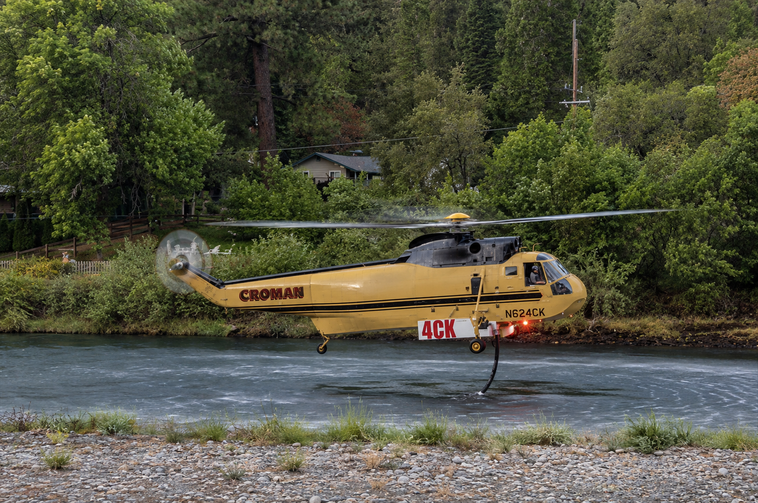
Oregon enters the second half of August with firefighters still spread across a landscape altered by one of the most extensive wildfire seasons in the state’s recorded history, as active incidents from Klamath County to Central and Eastern Oregon continue to demand crews, aircraft, equipment and emergency resources. More than 2.3 million acres have burned across Oregon during the 2026 season, surpassing the previous statewide record established just two years ago and leaving fire managers with weeks of traditionally dangerous summer weather still ahead.
The statewide numbers place the season into perspective. Oregon’s 2024 wildfire season had previously established the modern record at nearly 2 million acres burned, while the entire 2025 season affected approximately 339,000 acres. By early August this year, the state had already moved beyond the 2024 record, and the total has since climbed above 2.3 million acres. Oregon and Washington have remained among the busiest wildfire regions in the nation, with dozens of large incidents competing for firefighters, engines, helicopters, fixed-wing aircraft and specialized incident management personnel.
For residents across the state, those numbers are being measured not only in acreage but in evacuation notices, highway concerns, public-land closures, smoke, damaged landscapes and the continuing presence of fire crews in rural communities. In Southern Oregon, the Wrights Spring Fire in Klamath County and the Fielder Mountain Fire west of Rogue River have demonstrated two very different stages of wildfire suppression, while the Rosenbaum Fire farther north remains part of a broader collection of incidents being challenged by hot, dry and gusty conditions.
The Wrights Spring Fire remains one of the most consequential fires burning in Southern Oregon. As of Tuesday, August 18, the fire has burned approximately 53,941 acres and is reported at 53 percent containment. The fire has burned in the Fremont-Winema National Forests area west of Sprague River and southeast of Chiloquin, affecting the broader region around Bly Mountain, Swan Lake Rim, Bliss Road and nearby rural communities.
Evacuation restrictions remain part of the Wrights Spring emergency. Areas surrounding the fire have been placed under varying evacuation levels as conditions have changed, including Level 2 Be Set notifications, while the Oregon Pines area has been under a Level 3 Go evacuation order. Residents within affected areas should continue relying on Klamath County emergency notifications for their specific addresses because evacuation boundaries can be adjusted as suppression work advances or fire behavior changes.
Wrights Spring grew rapidly after beginning August 5, developing into a major wildland fire that threatened structures and required an expanded state response. Oregon invoked the Emergency Conflagration Act, allowing the Oregon State Fire Marshal to mobilize structural protection resources and its Green Incident Management Team. Structural task forces were positioned to protect homes and communities while wildland firefighters worked the expanding perimeter.
Progress around threatened communities eventually allowed the State Fire Marshal to begin releasing structural task forces and demobilizing its incident management team. Wildland firefighting operations, however, have continued across the sprawling perimeter. At more than 53,000 acres, Wrights Spring contains extensive areas requiring patrol, line improvement and continued monitoring even as containment increases.
The fire has also carried a human cost. Jason Ensign, 47, of Klamath Falls died while operating a bulldozer during suppression operations in the Yahwee Plateau area after rapidly advancing flames cut off his escape. His death underscored the dangerous conditions confronting equipment operators and firefighters working directly along active fire lines. Oregon later lowered flags in his honor.
Closer to Josephine and Jackson counties, the Fielder Mountain Fire became an immediate regional concern after breaking out west of Rogue River. The human-caused fire quickly expanded to several hundred acres and prompted Level 1, Level 2 and Level 3 evacuation notices as firefighters worked to prevent the flames from advancing toward homes and transportation corridors.
The fire’s location made the response particularly important for the Rogue Valley. Rogue River lies along Interstate 5 between Grants Pass and Medford, placing a developing wildfire within reach of populated areas and Oregon’s primary north-south transportation corridor. At one point, Level 3 evacuation territory extended from Interstate 5 toward East Evans Creek Road as emergency officials responded to the expanding incident.
ODF Southwest Oregon District firefighters, cooperating agencies and a Complex Incident Management Team attacked the fire while additional resources were moved into the area. Federal assistance was also authorized to help cover eligible firefighting costs. The fire was initially estimated at approximately 550 acres before more precise mapping placed it at approximately 573 acres.
Crews made substantial progress during the weekend. Firefighters established line around the perimeter and moved increasingly into mop-up operations, searching for and extinguishing remaining heat near control lines that could threaten containment. Earlier evacuation levels were reduced as the immediate threat declined. Residents in the Rogue River and East Evans Creek areas should nevertheless continue checking official Jackson County emergency information for the current status of individual evacuation zones rather than relying on earlier weekend notices.
Farther north, firefighters continue working the Rosenbaum Fire while preparing containment lines for another period of hot, dry and gusty weather. The lightning-caused incident became part of a demanding Central and Eastern Oregon wildfire workload in which crews have repeatedly moved between new starts and established fires while attempting to preserve enough resources for additional ignitions.
The Rosenbaum operation illustrates why containment requires continued work even after firefighters have established substantial portions of line around a fire. Wind can carry embers beyond existing control lines, while dry vegetation can support renewed fire activity from heat remaining inside a perimeter. Crews continue strengthening lines, extinguishing hot spots and monitoring areas capable of producing additional spread as weather conditions become less favorable.
The pressure extends well beyond these three fires. At one point in August, nearly 11,800 personnel were assigned to approximately 30 large fires across Oregon. The Bureau of Land Management has maintained fire restrictions on its public lands in Oregon and Washington and has used emergency closures where active fires created unacceptable risks to visitors and firefighters. Some restrictions are beginning to ease as individual incidents improve. Portions of BLM-managed land affected by the Fox Fire reopened Tuesday, August 18, although the Spring Recreation Site and Bassar Diggins Campground remain closed while suppression repair continues. Other public lands within active fire areas remain restricted.
The acreage already burned will leave consequences extending beyond the final days of suppression. Fire-damaged watersheds can become vulnerable to erosion when autumn and winter rains arrive, while burned forests and rangelands face lengthy recovery periods. Recreation areas, wildlife habitat, grazing lands and rural economies can experience effects long after smoke disappears and firefighting camps are dismantled.
Oregon’s 2026 season has also demonstrated how quickly the status of an individual fire can change. Wrights Spring expanded into a major emergency requiring structural protection and widespread evacuations before firefighters gained greater control. Fielder Mountain moved rapidly toward populated areas before crews established perimeter line and began mop-up. Rosenbaum remains under active suppression while firefighters prepare for weather capable of challenging previous gains.
For residents, evacuation terminology remains critical throughout the remainder of the season. Level 1 means Be Ready and signals that residents should prepare themselves, family members, pets and essential belongings for possible evacuation. Level 2 means Be Set and indicates significant danger requiring residents to be prepared to leave immediately. Level 3 means Go and directs residents to evacuate without delay. Those designations can change quickly, and people living near active incidents should depend on county emergency management agencies and official fire authorities for address-specific instructions.
With more than 2.3 million acres already burned, 2026 has moved beyond comparison with an ordinary Oregon fire season. The state has surpassed the record set during the extraordinary 2024 season and burned several times the acreage recorded throughout all of 2025. Firefighters have contained some incidents, slowed others and protected communities that faced rapidly advancing flames, but the statewide firefighting system remains engaged across a vast geographic area.
For communities from the Rogue Valley and Klamath Basin to Central and Eastern Oregon, the remainder of August will require continued attention to evacuation notices, fire restrictions, smoke conditions and changing weather. Containment gains at Wrights Spring and Fielder Mountain provide measurable progress, while Rosenbaum and numerous other active incidents keep thousands of firefighters working across the state. Oregon has already crossed a historic threshold in 2026, and the work of containing its fires, protecting its communities and eventually repairing millions of burned acres remains far from finished.