


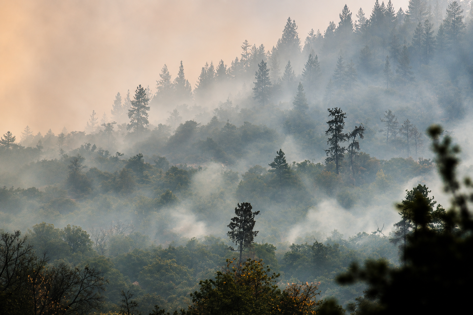
Wildfire smoke is pressing across portions of Oregon this weekend, prompting an air quality advisory as the state confronts another round of dangerous fire weather and continues suppression work on some of the largest wildfires of an already extraordinary 2026 season. The advisory extends through noon Monday for Crook, Jefferson, Umatilla, Union and Wasco counties, where smoke from fires burning across Oregon and the surrounding region may periodically push air quality into unhealthy ranges.
The alert comes during a weekend in which Oregon’s wildfire threat remains divided between two fronts. Firefighters are making substantial progress on established incidents, with several major fires now above 90 percent containment, while wind, extremely low humidity and dry thunderstorms continue to create conditions capable of producing new fires or challenging containment lines already built around existing ones. Saturday’s Red Flag Warnings covered a broad sweep of central, north central and eastern Oregon, keeping crews on heightened watch despite improving numbers on the state’s major incidents.
Smoke has become the most widespread consequence of those fires for communities outside the immediate burn areas. Fine particulate matter can travel considerable distances from an active wildfire, crossing county boundaries and mountain ranges before settling into populated valleys. Wind direction, terrain and overnight temperature changes can produce sharp differences in air quality within relatively short distances, leaving one community beneath heavy haze while another nearby experiences substantially clearer conditions.
Oregon health and environmental agencies advise residents to pay attention to current local air quality conditions rather than relying solely on what the sky looks like. Wildfire smoke can irritate the eyes and respiratory system and can aggravate cardiovascular and lung conditions. Children, older adults, pregnant people and people with existing heart or respiratory illnesses can be particularly susceptible when smoke concentrations increase. Reducing strenuous outdoor activity during periods of poor air quality can limit exposure until conditions improve.
The smoke advisory arrives after a fire season that has already burned approximately 2.6 million acres across Oregon. That statewide total has been driven in part by several exceptionally large incidents that have consumed vast sections of rangeland, forest and wilderness since lightning storms ignited numerous fires in July. The acreage continues to distinguish 2026 as one of Oregon’s most consequential wildfire seasons in recent years, even as the operational picture has improved considerably since the rapid fire growth recorded earlier this summer.
Among the largest remaining incidents is the Rowe Creek Complex in north central Oregon, where approximately 374,000 acres have burned. Containment has climbed to about 89 percent following weeks of work around an enormous perimeter. The improvement has allowed structural protection resources deployed through the Oregon State Fire Marshal to demobilize, while wildland crews continue searching for residual heat, reinforcing fire lines, patrolling vulnerable sections of the perimeter and repairing areas affected by suppression operations.
Containment at that scale does not mean every acre inside the perimeter has stopped burning. Large wildfires can retain heat for weeks in heavy vegetation, root systems and pockets of unburned material. Winds can expose those areas and increase fire activity even after most of the perimeter has been secured. Federal land managers have reduced some emergency closures as conditions around Rowe Creek improve, although portions of the burned area remain restricted because of active operations, weakened trees, unstable terrain and other post fire hazards.
The Big Grass Fire remains another enormous presence on Oregon’s wildfire map. Burning across Malheur County and neighboring Owyhee County, Idaho, the lightning caused fire has reached approximately 578,635 acres and was reported at about 89 percent containment Saturday. More than 560 firefighters and support personnel remained assigned to the incident, supported by engines, hand crews, bulldozers, water tenders and aviation resources across a fire footprint spanning roughly 900 square miles.
Wind has continued to test that perimeter. Gusts approaching 50 mph moved through portions of the Big Grass incident Friday, creating another demanding period for firefighters attempting to hold containment lines across open grass and brush country. The fire began July 23 and expanded rapidly through the Oregon Idaho border region, affecting ranching areas and rural transportation corridors while requiring one of the largest suppression responses of Oregon’s summer.
Closer to the Cascade Range, the Grasshopper Fire east of Mount Hood remains active across portions of Wasco, Hood River and Clackamas counties. Updated mapping has placed the fire above 90,000 acres, with containment reaching approximately 70 percent. Lightning also started that fire July 23, and its spread through forest and wilderness terrain has required crews to operate across difficult country near the Badger Creek Wilderness.
Saturday’s combination of low humidity and strong wind kept the Grasshopper perimeter under close observation. Firefighters must continue securing areas where remaining heat could reach unburned vegetation, particularly when wind can carry embers beyond established control lines. Smoke generated by Grasshopper and other fires across central and eastern Oregon is contributing to the regional haze now affecting communities included in the air quality advisory.
Some of the strongest progress is being reported on the Henry, Coyote and Shingle fires, three incidents that generated substantial firefighting activity earlier in the season. The Henry Fire was reported at 97 percent containment after burning approximately 29,900 acres. The Coyote Fire reached 94 percent containment at approximately 17,460 acres, while the Shingle Fire stood at 93 percent after burning more than 73,000 acres across portions of Crook, Grant and Wheeler counties.
Those figures represent weeks of work constructing and strengthening control lines, extinguishing heat along fire edges and protecting surrounding communities and infrastructure. As the fires move closer to full containment, operations increasingly concentrate on patrol, mop up and suppression repair. Firefighters continue checking for residual heat capable of resurfacing during windy and dry weather, while land managers evaluate when roads, recreation areas and public lands affected by emergency closures can safely reopen.
The improving containment percentages have significantly changed Oregon’s wildfire picture from earlier this summer, when multiple fires were expanding simultaneously and crews were moving between new starts across the state. They have not eliminated the underlying conditions that allowed those fires to grow. Vegetation remains exceptionally dry across large portions of Oregon, and the combination of wind, low humidity and lightning can still turn a new ignition into a fast moving wildfire.
For residents under the current air quality advisory, the continuing fire season is arriving through smoke rather than evacuation notices. Conditions may change repeatedly through Monday as winds transport smoke away from some communities and into others. Valleys can experience heavier concentrations during overnight and morning hours before daytime heating and shifting winds disperse the smoke.
Oregon enters the final portion of August with firefighters holding increasingly firm lines around several of the summer’s major incidents, but with millions of acres already burned and significant fire activity still present from the Cascades to the Idaho border. The Rowe Creek Complex, Big Grass Fire and Grasshopper Fire continue to require active suppression work, while Henry, Coyote and Shingle move steadily toward full containment. Until cooler and wetter weather brings a broader change across the landscape, smoke, dry fuels and the possibility of another ignition remain part of Oregon’s late summer forecast.